Hana Highway covers 64.4 miles of Routes 36 and 360, and Hawaii's tourism authority puts the drive at two to four hours each way. Guided days listed on this site run 4 to 12.5 hours, with pickups in Kahului, Lahaina and Paia.
This road is short in miles and long in hours, and almost every stop on it has a gate, a cap or an opening time. Here is how the route is built and what sits along it.
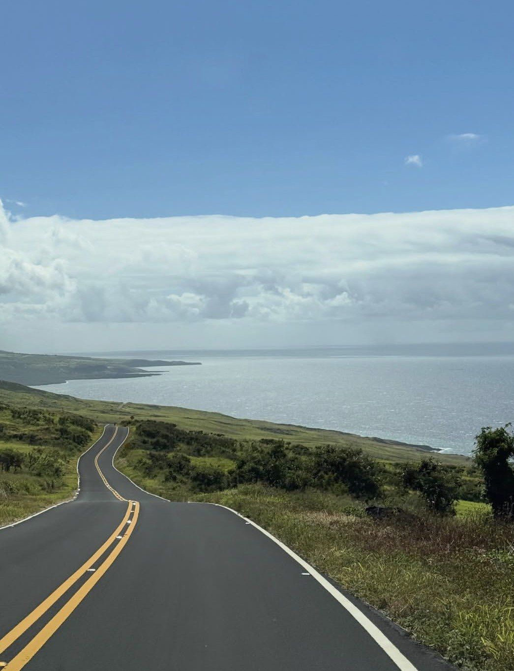
Hana Highway runs 64.4 miles along Hawaii Routes 36 and 360 between Kahului and Hana. Hawaii's tourism authority measures Hana at 52 miles from Kahului and puts the drive at two to four hours one way, because the road carries 620 curves and 59 bridges, 46 of them a single lane wide where oncoming traffic takes turns. Route 36 runs from Kaahumanu Avenue to Kaupakalua Road. Route 360, the twisting section people mean when they talk about the drive east, begins at Kaupakalua Road and ends at Keawa Place just before Hana Bay.
An automobile route opened on December 18, 1926, after bridge and road construction that ran from 1900 through 1947, and full paving arrived only in the 1960s. On June 15, 2001 the highway was added to the National Register of Historic Places as a historic district, and 59 bridges built between 1908 and 1947 are still in use along it as part of the Hana Belt Road Historic District. Maintenance of the highway falls to the Hawaii Department of Transportation, while the continuation past Hana is a Maui County road.
Timings on this road are set by gates rather than by distance. Waianapanapa State Park opens daily 7:00 a.m. to 6:00 p.m., reservations are required for both entry and parking, they release 30 days in advance one day at a time at midnight Hawaii Standard Time, the day is split into four time slots and visitors must be inside by 5:30 p.m. Twin Falls at mile marker 2 opens its gates at 7:10 a.m. and stops admitting at 4:30 p.m. The Kipahulu District of Haleakala National Park, 12 miles past Hana town, is open 24 hours.
Highway length64.4 miles
↩
Curves on HI-360620
Bridges59, with 46 single-lane
Kahului to Hana52 miles, 2 to 4 hours
Rain at Hana82.28 inches a year
Waianapanapa hours7:00 a.m. to 6:00 p.m.
2 to 4 hours
52 miles from Kahului, two to four hours
Hawaii's tourism authority puts Hana at 52 miles from Kahului and the drive at two to four hours one way. One-lane bridges and hairpin turns set that pace, and traffic on the narrow sections adds to it. The guided days on this site therefore run between 4 and 12.5 hours.
46 of 59
Most bridges carry one lane
Of the 59 bridges on the highway, 46 are only a single lane wide, so oncoming traffic has to take turns. The bridges were built between 1908 and 1947 and are part of a listed historic district. Expect stop-and-wait stretches on any itinerary.
4 hours
Kipahulu sits 12 miles past Hana town
National Park Service figures put the drive from Kahului to the Kipahulu District of Haleakala National Park at approximately 4 hours, via Route 36 to 360 to 31. Its GPS address is Mile Marker 41 Hana Hwy. The district is open 24 hours, so daylight sets the limit out there.
4 miles
Pipiwai Trail to 400-foot Waimoku Falls
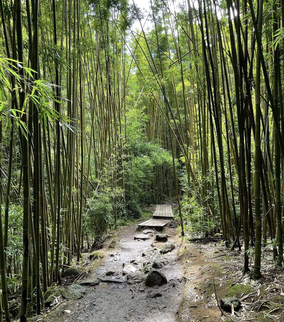
Pipiwai Trail runs 4 miles round trip with 800 feet of climbing and is rated moderately strenuous by the NPS. The Makahiku Falls overlook comes about 0.5 miles in, a bamboo forest with boardwalks about a mile in, and the Waimoku Falls viewing area at two miles one way. Wear sturdy hiking shoes.
0.5 miles
The Pools of Oheo are view-only
NPS states the pools are not accessible for entry due to safety concerns and are viewed from the Kuloa Point Trail, 0.5 miles total with 80 feet of climbing from the Kipahulu Visitor Center. NPS also advises against wading in the park's streams. The same loop passes archaeological sites.
55 spots
Twin Falls at mile marker 2 fills first
This first major stop on the road has 55 paid parking spots on a first-come basis with no reservations, and roadside parking means being refused entry. Gates open at 7:10 a.m., last admission is 4:30 p.m. and everyone must leave by 5:00 p.m. It is closed to out-of-state visitors on the first Saturday of every month.
Waianapanapa State Park
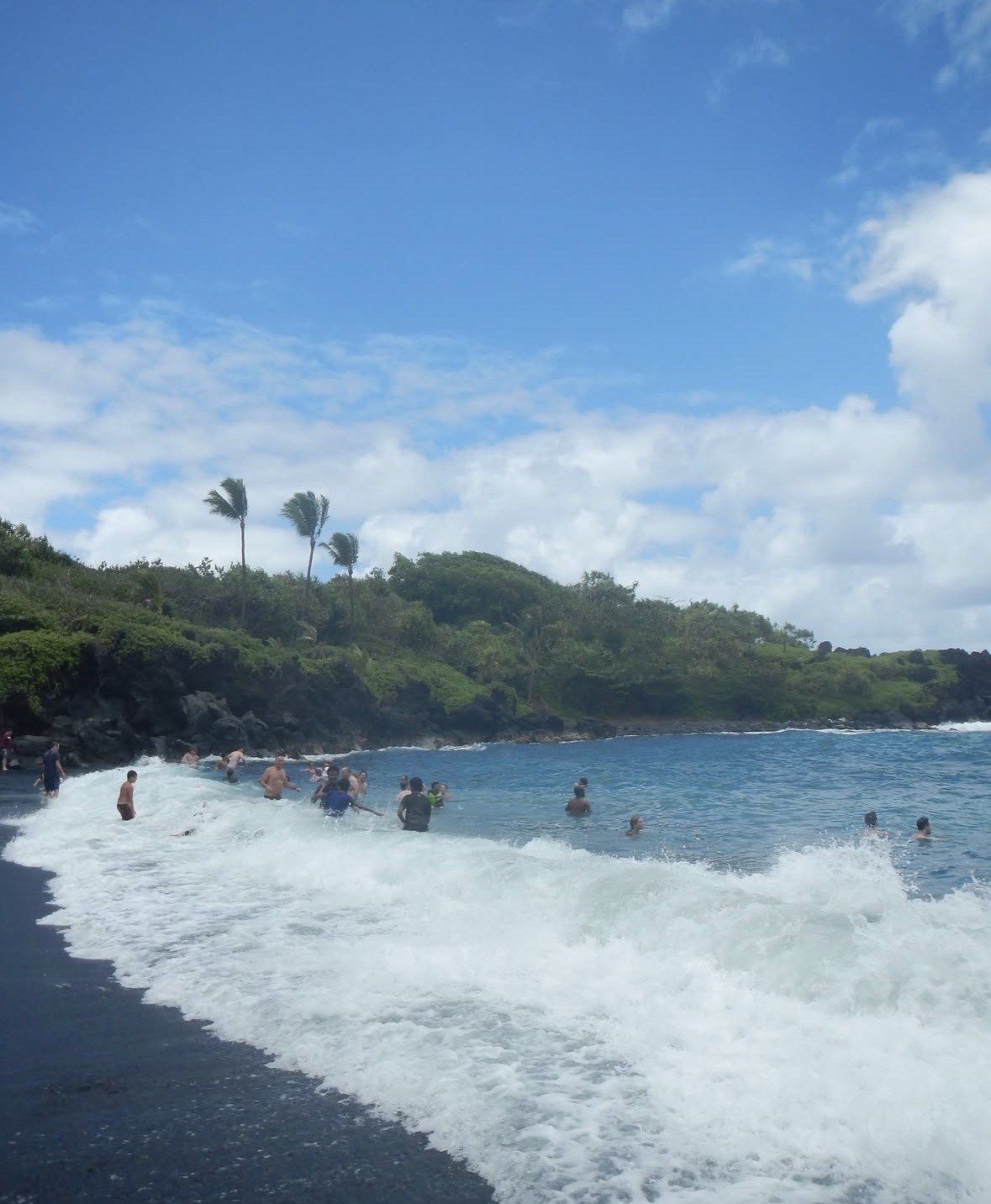
Hana's black sand beach sits in a park of native hala forest, a heiau, sea stacks, blow holes, a natural stone arch and a seabird colony, with the ancient Ke Ala Loa O Maui/Piilani coastal trail running toward town. Hours are 7:00 a.m. to 6:00 p.m. and both entry and parking are reserved in advance. Several departures listed here include the admission, which is the simplest way through that system.
Pipiwai Trail, Kipahulu District
The trail runs four miles round trip with 800 feet of climbing, rated moderately strenuous by the NPS, and passes through a boardwalked bamboo forest to 400-foot Waimoku Falls. Allow most of a morning or afternoon for it. No food or gas is sold inside the park, though drinking water is available at the Kipahulu Visitor Center.
Kuloa Point Trail and the Pools of Oheo
A 0.5-mile loop with 80 feet of climb from the visitor center, reaching ocean views, archaeological sites and the viewpoint over the pools. This is the honest alternative if Pipiwai is too much. The visitor center itself is accessible, with accessible parking and restrooms on a paved path, while the trails beyond are muddy, steep and rocky.
Kahanu Garden and Piilanihale Heiau
At 650 Ulaino Road in Hana stands Piilanihale Heiau, believed to be the largest ancient structure in Polynesia. The self-guided route runs 9 a.m. to 3 p.m. Monday to Friday, with everyone out of the garden by 3:30 p.m., and takes about an hour as a minimum. It is closed at weekends, which catches out plenty of itineraries, and online reservations are encouraged.
Garden of Eden Arboretum, mile marker 10.5
Twenty-six acres of trails and hidden waterfalls at 10600 Hana Highway, open 8:00 a.m. to 4:00 p.m. daily. It works as a leg-stretch with a coastal view rather than a half-day commitment. Pair it with the forested rest stop at Kaumahina State Wayside, which has picnicking and a northeast-coast viewpoint but no drinking water.
Banana bread, pizza and the Friday market
Aunty Sandy's stand at Keanae is Monday to Saturday 8:30 a.m. to 2:30 p.m., reached by turning left off the highway just after mile marker 16. Coconut Glen's dairy-free coconut-milk ice cream sits at mile marker 27 and a half. Hana Farms at 2910 Hana Highway, past mile marker 31, opens Saturday to Thursday 9 a.m. to 5 p.m. and Friday 9 a.m. to 8 p.m., with wood-fired pizza at its Bamboo Hale grill, and the Hana Farmers Market runs Fridays 2:30 to 5:30 p.m. at Hana Town Center.
How a guided day east stacks up against the other big East and Upcountry Maui outings.
Most visitors have room for two or three big days on Maui, and a Road to Hana tour takes a full one: departures here start between 5:50 a.m. and 8:30 a.m. and run from 4 to 12.5 hours. The alternatives below pull in different directions, one before dawn at altitude, one a short morning four miles from Kahului, one on another island entirely. The table shows which of them actually competes for the same day.
Crowds
Price
Best For
What Sets It Apart
★ Road to Hana
Heaviest in the opening miles once the gates have been open an hour; guided pickups run from 5:50 a.m.
Tours on this site from $200 to $599
A full day of waterfalls, one-lane bridges, the black sand beach and a national park at the end
620 curves and 59 bridges over 64.4 miles, listed on the National Register of Historic Places since 2001
Haleakala Summit sunrise
Concentrated into the 3:00 a.m. to 7:00 a.m. entry window
Needs its own per-vehicle reservation for 3:00 a.m. to 7:00 a.m. entry
Early risers who want the crater rim at first light
A separate district of the same national park as Kipahulu, covered by the standard 3-day pass
Paia and Hookipa Beach
Steady foot traffic in a small town four miles east of Kahului
No timed ticket; shops, galleries and restaurants
A half morning, or the Paia start of the 4 to 5 hour private tour
Rustic storefronts plus Hookipa, called the windsurfing capital of the world by Hawaii's tourism site
Hawaii Volcanoes National Park
Spread over a far larger park on a different island
Covered by the Hawaii Tri-Park Annual Pass alongside Haleakala and Puuhonua o Honaunau
Travellers adding Hawaii Island to the same trip
Needs an inter-island flight, so it never competes for the same Maui day
A Road to Hana tour is the only one of these that is a single continuous day on one road, with 46 single-lane bridges, state waysides, botanical gardens and the Kipahulu District of Haleakala at the far end about 4 hours from Kahului. The summit sunrise sits in the same park but a different district and its own reservation window, so it belongs on another morning. Volcanoes needs a flight.
Practical info
Road to Hana tour: what to know before you book
Access, seasons, gear, etiquette and safety for a day on the Hana Highway.
How to reach the Hana Highway and where tours pick up
Kahului is the hub. Route 36 runs from Kaahumanu Avenue out to Kaupakalua Road, where Route 360 takes over and winds to Keawa Place just before Hana Bay. Paia sits about four miles east of Kahului and holds the last gas station on the highway before Hana. The National Park Service gives the route to Kipahulu as Route 36 to 360 to 31, roughly 4 hours from Kahului.
Public transport does not reach either district of Haleakala National Park, so the guided day is the practical way in. Pickup arrangements differ: some departures collect you at a resort, hotel, condo, harbour or private residence, while others use set points. The Mercedes van day meets at Cannery Mall Lahaina at 6:00 a.m., the Maalaea Park & Ride at 6:30 a.m. and the Kahului Park & Ride at 6:40 a.m., with no pickups in Napili-Honokowai, Kahana, Kapalua, Makawao, Kula or Paia.
Route 36 runs Kaahumanu Avenue to Kaupakalua Road; Route 360 runs Kaupakalua Road to Keawa Place
Early hotel pickup windows of 5:50 to 6:30 a.m. on the farm-to-table day, or a central meet outside Starbucks at 120 Ho'okele St, Kahului
Island guests on the most reviewed small-group day meet at 7:00 a.m. at 434 Kahiki St, Kahului
Cruise passengers from Kahului Harbor start at 8:30 a.m. on two of the listed departures
Kahului-based 7 to 8 hour day meets island guests at 7:20 a.m. and cruise guests at 8:30 a.m. by the Burger King parking lot
Helicopter combination checks in at Blue Hawaiian Helicopters, 1 Lelepio Pl, Kahului, with no hotel pickup and a $24 fee at check-in
Half-day private tour starts at Island Fresh Cafe in Paia with reserved secure parking
Best time to go and what the weather does
Rain is the baseline here. Hana averages 82.28 inches a year and every single month averages at least 4 inches, with March the wettest at 9.52 inches and June the driest at 4.08 inches. June through September sit at the lower end, so if you want the best odds of dry waterfall stops, aim there. Mean temperature barely moves, from about 71.0 °F in February to 76.9 °F in August.
National Weather Service seasons split Hawaii into summer from May through October and winter from October through April, when clouds and rainstorms are more frequent and trade winds can be interrupted for days. East Maui is windward, picking up rain from both winter fronts and trade-wind showers, so the seasonal gap is smaller here than on the leeward side. Daylight is the bigger constraint: at Hana the sun sets about 7:08 p.m. on the summer solstice and about 5:48 p.m. on the winter solstice.
Annual average rainfall 82.28 inches, with no month below 4 inches
Mean temperature from about 71.0 °F in February to 76.9 °F in August
Summer solstice at Hana: sunrise about 5:44 a.m., sunset about 7:08 p.m.
Winter solstice: sunrise about 6:56 a.m., sunset about 5:48 p.m., roughly 11 hours of light
HDOT lists weekday alternating single-lane closures 7 a.m. to 5 p.m. near Waikamoi at mile markers 9.79 to 10, Keanae at 13.9 to 14.2 and Wailua at 19.5 to 19.6
Roving shoulder closures run 12:30 a.m. to 11 a.m. between mile markers 3 to 6, 10 to 13, 13.5 to 16.2, 18 to 20 and 26 to 30
Avoid the first Saturday of the month if Twin Falls is on the itinerary, and weekends if Kahanu Garden is
What to pack for a long, wet day
Footwear first. The NPS highly recommends sturdy hiking shoes for East Maui trails, which can be steep with loose cinders or rocks, and advises planning for rain at any time of year. Bring a light rain shell, a refillable bottle (drinking water is available at the Kipahulu Visitor Center, though no food is sold in the park), and a swimsuit and towel if your departure includes swim breaks at the black sand beach or a freshwater pool.
For sun and insects, NOAA points to mineral sunscreen rather than products using oxybenzone, octinoxate or octocrylene, and rates UV-protective sun shirts and pants as a strong option, with shade between 10 a.m. and 2 p.m. Hawaii's Department of Health advises an EPA-registered repellent with 20 to 30 percent DEET, or picaridin, oil of lemon eucalyptus or IR3535, plus long sleeves and light-coloured clothing. Pack light: on the 6 to 8 passenger day, bags must fit under the seat.
Sturdy hiking shoes, highly recommended by the NPS for steep, rocky East Maui trails
Rain layer for any month, since every month at Hana averages at least 4 inches
Mineral sunscreen, avoiding oxybenzone, octinoxate and octocrylene
Sun shirt or long sleeves, with shade sought between 10 a.m. and 2 p.m.
Repellent with 20 to 30 percent DEET, or picaridin, oil of lemon eucalyptus or IR3535
Refillable water bottle; drinking water is available at the Kipahulu Visitor Center
Swimsuit and towel for departures with swim breaks, conditions permitting
A small bag only on the 6 to 8 passenger tour, which allows no luggage and no alcohol on board
Local etiquette and the official code of conduct
Hawaii's tourism authority publishes a code of conduct for this road and it is worth reading before you go. Park only in designated stalls, since vehicles protruding onto the highway can be towed. Avoid sites on or beyond private property and places without visitor-welcoming signage. Use State park and County rest facilities rather than roadside stops, and stay out of streams during heavy rain or flash-flood conditions. The same page recommends taking the road on a permitted tour led by professional guides.
Spending along the route is part of that guidance, which asks visitors to support farms, botanical gardens and fruit stands. In Hana town, the tourism authority names Hana-Maui Resort, Hasegawa General Store and Hana Ranch Store as the main services, and Hana Health's Hana Fresh farm stand at 4590 Hana Highway sells produce from more than 100 varieties of vegetables, fruits, herbs and traditional Hawaiian crops. Hana Cultural Center on Uakea Road requests a $3 donation per person.
Park in designated stalls only; vehicles protruding onto the highway can be towed
Skip sites on or beyond private property and anywhere without visitor-welcoming signage
Legal parking and restroom stops are Kaumahina State Wayside (7.8 acres), Wailua Valley State Wayside (1.5 acres), Puaa Kaa State Wayside (5.0 acres) and Waianapanapa State Park
Wailua Valley State Wayside looks over Keanae Valley, the Koolau Gap and Wailua village taro fields
Puaa Kaa State Wayside has small waterfalls and pools and is open daylight hours
Buy at the farm stands: Aunty Sandy's at Keanae runs Monday to Saturday 8:30 a.m. to 2:30 p.m.
Hana Cultural Center lists Wednesday and Friday 10:00 a.m. to 3:00 p.m. hours and a notice that the museum and gift shop remain closed, with visits by request, so confirm before counting on it
Health, water and remoteness on the far side
This far end of the road is genuinely remote. NPS states that at Kipahulu emergency medical assistance is at least one hour away and that neither gas nor food is sold in the park. Streams are the main hazard: the park service warns water can rise as fast as 4 feet in 10 minutes, and lists leptospirosis and E. coli as water-quality hazards along with rock falls in gulches and below waterfalls. Entry to the Pools of Oheo is not allowed.
Stay out of streams during heavy rain or flash-flood conditions, as the official code of conduct instructs, and out of closed areas. Hawaii's beach-safety service lists no Hana-side beaches among its monitored Maui beaches and notes lifeguards are not always on duty or available, so treat swim breaks as a judgement call. On mosquitoes, the Department of Health says Hawaii has two species capable of transmitting disease but that no mosquito-borne diseases are currently spreading locally.
Emergency medical help at Kipahulu is at least one hour away, per the NPS
No gas and no food are sold inside Haleakala National Park; the last gas on the highway before Hana is in Paia
East Maui streams can rise as fast as 4 feet in 10 minutes
Leptospirosis, E. coli and rock falls are the hazards the NPS names for pools and gulches
Entry into the Pools of Oheo is not allowed; view them from the Kuloa Point Trail
Hana-side beaches are not among Hawaii's monitored Maui beaches and lifeguards are not always on duty
No mosquito-borne diseases are currently spreading locally in Hawaii, says the Department of Health
Location
Where a Road to Hana tour runs
Routes 36 and 360 run 64.4 miles from Kahului to Hana, continuing 12 miles past town to the Kipahulu Visitor Center at Mile Marker 41 Hana Hwy, Hana, HI 96713.
Plan your visit
Practical information for a Road to Hana tour
The road, the stops, the parks, the weather and the villages along Hawaii Route 360, from Kahului to Hana and on to Kipahulu.
Straight answers on timings, pickups, park entry and weather on the Hana Highway, based on official state, HDOT and National Park Service information.
Hana Highway covers 64.4 miles of Hawaii Routes 36 and 360 between Kahului and Hana, and Hawaii's tourism authority puts Hana 52 miles from Kahului with a drive of two to four hours one way. The reason is the shape of the road: 620 curves and 59 bridges, 46 of them a single lane wide, where oncoming traffic takes turns. That is why the guided days listed here run from 6 hours up to 12.5 hours rather than a quick morning out. If you continue past Hana town to the Kipahulu District of Haleakala National Park, the National Park Service puts that drive at about 4 hours from Kahului.
Hawaii's official tourism page recommends taking the road on a permitted tour led by professional guides. A guide handles the one-lane bridges, the blind curves and the mile-marker turnoffs while you look out of the window instead of at the next hairpin. Several of the trips here also cover park admission and parking fees, which removes the timed-entry paperwork from your day. For anyone travelling solo, prone to motion sickness or unused to narrow mountain roads, the guided option is the easy call.
Half Day Private VIP runs 4–5 hours from $279, rated 4.9 ★ (127 reviews), with a private air-conditioned vehicle, snacks, drinks and boogie boards, starting at Island Fresh Cafe in Paia with reserved secure parking so you can wander historic Paia afterwards. Meals are not included on that one. Cruise passengers are better served by the Kahului day trip, 7–8 hours from $200, rated 4.7 ★ (159 reviews), where cruise guests meet at 8:30 a.m. by the Burger King parking lot and island guests at 7:20 a.m. in Kahului. That same trip has no minimum party size, so one person can travel.
Some do, and it matters because the park operates on timed tickets. Waianapanapa is open daily 7:00 a.m. to 6:00 p.m., reservations are required for both entry and parking, they are released 30 days ahead one day at a time at midnight Hawaii Standard Time, same-day slots are not sold, the day is split into four time slots, and visitors must be inside by 5:30 p.m. The Farm to Table trip from $259 lists Waianapanapa admission and parking fees as included; the 12.5-hour Adventure tour from $277 includes all admission and park entry fees; the limo-van and helicopter combination from $599 also includes park entry. Inside you get a native hala forest, a heiau, sea stacks, blow holes, a natural stone arch, a seabird colony, a small black sand beach and the ancient Ke Ala Loa O Maui/Piilani coastal trail toward Hana.
Pickup geography varies a lot, so read this before booking. The Mercedes van trip from $250, rated 4.8 ★ (1278 reviews) and capped at 14 people, collects at 6:00 a.m. from Cannery Mall Lahaina, 6:30 a.m. at the Maalaea Park & Ride and 6:40 a.m. at the Kahului Park & Ride, with no pickups in Napili-Honokowai, Kahana, Kapalua, Makawao, Kula or Paia. If you want collection at the door, the Small-Group Luxury tour from $385 includes pickup and return at resort, hotel, condo, harbour or private residence, and the Farm to Table trip offers hotel pickup in a 5:50 to 6:30 a.m. window or a central meet outside Starbucks at 120 Ho'okele St, Kahului.
Kipahulu District of Haleakala National Park sits 12 miles past Hana town at the GPS address Mile Marker 41 Hana Hwy and is open 24 hours. The Pools of Oheo cannot be entered for safety reasons; the National Park Service says they are viewed from the Kuloa Point Trail, 0.5 miles with 80 feet of climbing. The bigger walk is the Pipiwai Trail, 4 miles round trip with 800 feet of climbing and rated moderately strenuous, passing the Makahiku Falls overlook about 0.5 miles in, a boardwalked bamboo forest about a mile in, and reaching the 400-foot Waimoku Falls at two miles one way. No gas or food is sold in the park, drinking water is available at the Kipahulu Visitor Center, and NPS notes emergency medical help is at least one hour away.
Rain is normal here all year. Hana averages 82.28 inches annually with every single month above 4 inches, peaking in March at 9.52 inches and easing in June at 4.08 inches, while mean temperature runs from about 71.0 °F in February to 76.9 °F in August. The National Weather Service divides Hawaii into a summer season from May through October and a winter season from October through April, but notes that windward East Maui takes rain from both winter storms and trade-wind showers, so the seasonal gap is small. Pick June if you want the driest average, and accept a shower whenever you come.
HDOT lists alternating single-lane closures near Waikamoi between mile markers 9.79 and 10, at Keanae between mile markers 13.9 and 14.2 near Honomanu Bay, and at Wailua between mile markers 19.5 and 19.6, all 7 a.m. to 5 p.m. on weekdays. There are also roving night-and-morning shoulder closures between mile markers 3–6, 10–13, 13.5–16.2, 18–20 and 26–30, from 12:30 a.m. to 11 a.m. Work zones on the narrowest sections add time that no map estimate accounts for, which is one more reason to let a guide absorb the delay. Check the HDOT Maui roadwork page on the morning you travel, since the list changes week to week.
Sturdy hiking shoes are highly recommended by the National Park Service, because East Maui trails can be steep with loose cinders or rocks and rain is possible at any time of year. NOAA favours mineral sunscreen over products with oxybenzone, octinoxate or octocrylene, and suggests sun shirts and seeking shade between 10 a.m. and 2 p.m. Hawaii's health department advises repellent with 20–30% DEET, or picaridin, oil of lemon eucalyptus or IR3535, plus long sleeves, long trousers and light-coloured clothing. Streams here can rise as fast as 4 feet in 10 minutes, and the official code of conduct tells visitors to stay out of streams during heavy rain or flash-flood conditions.
Food is included on most of the full days: the Farm to Table trip from $259 serves an authentic Hawaiian farm-to-table meal with drinks and snacks throughout, the 6-to-8-passenger small group from $282 does a continental breakfast with Maui-baked pastries and a hot made-to-order Hawaiian BBQ plate lunch with 48 hours' notice for vegetarian plates, and the Adventure tour with pickup from $210, rated 4.8 ★ (3642 reviews), includes breakfast of spam musubi or yogurt plus a sandwich or veggie wrap. Swim breaks at the Hana black sand beach or a freshwater waterfall pool come with the Small-Group Luxury tour from $385, conditions permitting, which also has individual leather captain's chairs and a Hawaii State Certified guide. For the waterfalls from above, the 6-hour limo-van trip from $599 pairs a 3.5-hour drive with a 36-minute Eco-Star helicopter flight and live commentary, checking in at Blue Hawaiian Helicopters, 1 Lelepio Pl, Kahului. Hotel pickup is not included on that one, a $24 fee is payable at check-in and there are weight restrictions to read first.
Pick the day length that suits your trip and see what each departure covers.
The road behind every Road to Hana tour: opened in 1926
An automobile route to Hana opened on December 18, 1926, after decades of bridge and road building between 1900 and 1947, and full paving came only in the 1960s. On June 15, 2001 the highway joined the National Register of Historic Places, with 59 bridges from 1908 to 1947 still carrying traffic.