In shortRoad to Hana weather means windward weather: showers most days, sun between them, and conditions that shift within a few miles. The gauge at Hana Airport averages 82.28 inches a year, and no month comes in under four. Start with the live widget on this page for the forecast, then open the state transport department's Maui roadwork listings, which currently show weekday single-lane closures from 7 a.m. to 5 p.m.
82.28 inmean yearly rain at Hana
4.08 inJune, the driest month
7 a.m. to 5 p.m.weekday lane-closure hours
4 ft in 10 minhow fast streams can rise
Road to Hana weather on the windward side
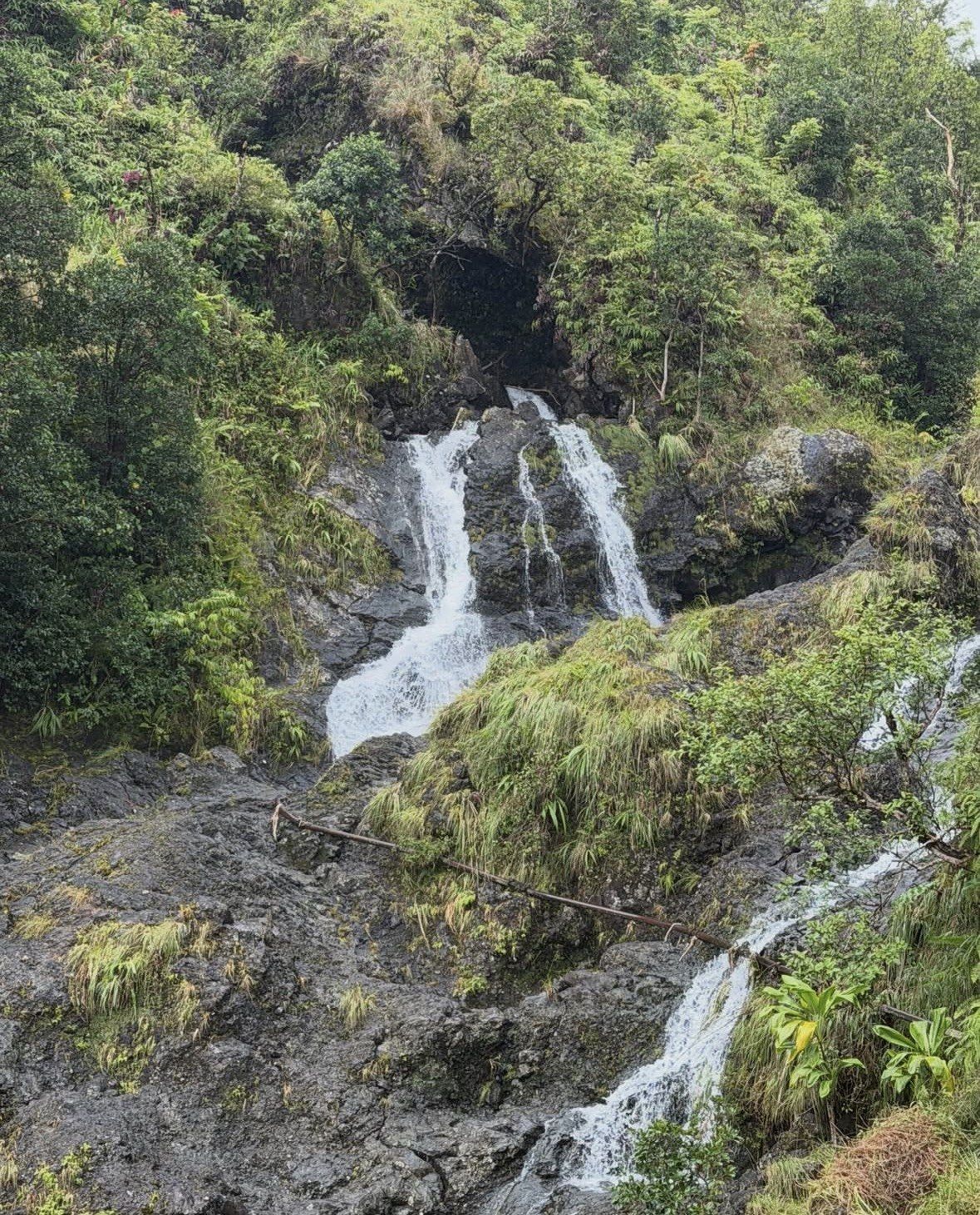
Rain is part of the baseline on this coast. The gauge at Hana Airport sits at a yearly mean of 82.28 inches across its 1950 to 2005 record, March leads the table at 9.52 inches and June sits at the bottom with 4.08, and nothing in between drops under four. On a normal day that plays out as a sequence: cloud builds over the gulches, a shower crosses the road for ten or fifteen minutes, then the sun comes back and the tarmac steams.
Where you are standing matters more than the daily forecast. Paia, about four miles east of Kahului, can be dry and bright while the Keanae stretch is under rain, and the ridge above Waikamoi can sit in cloud with the coast below it clear. Treat any single-point forecast as one data point for a road that climbs, drops and turns through 620 curves.
The National Weather Service splits Hawaii into a summer period from May through October and a winter period from October through April, while noting that windward areas like East Maui take rain from both winter storms and ordinary trade-wind showers, so the gap between the two is narrow here. Heat is never the variable. The monthly mean only travels from roughly 71.0 °F in February up to 76.9 °F in August and averages 74.05 °F over the year, which means the thermometer gives you no clue which month you are driving in. Pack for warm and wet whichever month you come.
Checking the live reading and the road itself
The weather widget on this page is the live reference. Look at it the evening before and again at breakfast, and read it for whether a heavy band is sitting over East Maui right now, since that is what decides how the streams behave. The daily symbol tells you much less.
The road needs its own check. Hawaii's transport department maintains the Hana Highway and publishes a Maui roadwork page listing each job by Route 360 mile marker, with the type of work and the hours it runs, while State Parks keeps a separate notice board for park closures. Asked whether the Road to Hana is open today, the usual answer is yes, with delays: the highway stays in service through most weather, and the realistic risk is losing forty minutes at a one-lane control point rather than finding a barrier across the road.
Copy two things from that page into your plan: which mile markers have active daytime work, and whether anything is listed near the stops you had in mind. Listings change week to week, so check on the morning you travel rather than relying on what you read when you booked.
Small group, full route, guide reading the weather
Eight to ten hours with 6 to 8 passengers, hotel pickup and drop-off, and all fees and taxes included, from $282 and rated 4.6 ★ (1092 reviews). The day's showers and lane closures land on the guide instead of you.
★ 4.6/5 · 1,092 reviews
Road to Hana road conditions currently published
Three daytime work zones sit in the middle miles at the moment, each running traffic through a single alternating lane on weekdays between 7 a.m. and 5 p.m. A separate crew handles roving shoulder closures for weed spraying overnight and into the late morning, which is why a weekday departure after about 7 a.m. feels slower than any map estimate suggests.
The practical move is simple: be past mile marker 20 before 7 a.m. on a weekday, or travel at the weekend when the alternating-lane crews are not out. Coming home after 5 p.m. puts you back through the same stretches with the cones gone.
| Location | Mile markers | Work and traffic control | Hours |
|---|
| Waikamoi | 9.79 to 10 | Slope work and road restoration, alternating single lane | 7 a.m. to 5 p.m., weekdays |
|---|
| Keanae, near Honomanu Bay | 13.9 to 14.2 | Soil stabilisation and guardrail repair, alternating northbound single lane | 7 a.m. to 5 p.m., weekdays |
|---|
| Wailua | 19.5 to 19.6 | Soil stabilisation and guardrail repair, alternating northbound single lane | 7 a.m. to 5 p.m., weekdays |
|---|
| Nahiku to Kaelelu | 25 to 31 | Guardrail landscaping | 6:30 a.m. to 3 p.m. |
|---|
| Roving, five segments | 3 to 6, 10 to 13, 13.5 to 16.2, 18 to 20, 26 to 30 | Shoulder closures for weed spraying | 12:30 a.m. to 11 a.m. |
|---|
Heavy rain, rising streams and park closures
Flash flooding is the one weather risk on this road that deserves a hard rule. The National Park Service measures East Maui streams gaining as much as 4 feet in 10 minutes, and rain falling in the uplands reaches the coast long before the sky above you looks any different. Hawaii's official code of conduct is blunt about it: do not enter streams during heavy rain or flash-flood conditions.
At Kipahulu the park service goes further. It does not recommend wading in the streams at all, lists leptospirosis and E. coli among the water-quality hazards, and warns about rock falls in gulches and below waterfalls. Entry into the Pools of Oheo is barred on safety grounds whatever the water is doing, so the looking is done from the Kuloa Point Trail, 0.5 miles with 80 feet of climbing. Emergency medical help out there is at least an hour away, so stay on the trail and off the wet rock.
Weather closes things outright as well. A storm precaution took camping at Waianapanapa State Park offline from 9/24 through 9/28 in 2026, which is what an autumn system looks like in practice at a park standing open to the ocean at the far end of the drive. Entry and parking there come by reservation released 30 days ahead at midnight Hawaii Standard Time, with nothing available on the day, so a storm-hit date is a problem worth handing to somebody else.
- Stay out of streams and pools while heavy rain or flood conditions last, as the official code of conduct instructs.
- Expect muddy, steep, rocky ground on the Kipahulu trails; the park service strongly recommends sturdy hiking shoes.
- Plan for rain in any month and carry a layer rather than an umbrella, given the wind on the exposed stretches.
- Park only in designated stalls: vehicles protruding onto the highway can be towed, and the shoulders narrow fast when it is wet.
How a guided day absorbs delays and reroutes
A guide driving this road several times a week already knows what the roadwork page says and where the day's rain has landed. When a single-lane control point backs up near Waikamoi, the stops get reordered rather than dropped. When a waterfall pool is running brown, the swim break moves to the coast. A grey start at Paia turns nobody around, because showers and breaks are the normal shape of a day here.
The recommendation on Hawaii's official tourism page is that visitors take the road as a permitted guided tour rather than at their own wheel, and a doubtful forecast is exactly where that advice pays. On a wet date the timing reasons pile up: no reservation calendar to watch at midnight Hawaii time, no judgement call of your own at a stream crossing, and no driving 620 curves and 46 one-lane bridges home in the dark with a windscreen full of spray.
For the full route on a day with an uncertain forecast, the 8 to 10 hour small-group tour carries 6 to 8 passengers with hotel pickup and all fees and taxes covered, from $282, rated 4.6 ★ (1092 reviews). The lowest starting price on a complete day out of Kahului is the 7 to 8 hour trip, from $200, rated 4.7 ★ (159 reviews). If the forecast looks bad and you only want the first stretch, the 4 to 5 hour private trip from Island Fresh Cafe in Paia costs from $279, rated 4.9 ★ (127 reviews), and has you back before the afternoon build-up.
Questions people ask
Is there a dry season on the Road to Hana?
Not in any useful sense. The National Weather Service divides Hawaii into summer from May through October and winter from October through April, then notes that windward areas such as East Maui collect rain from both winter storms and everyday trade-wind showers, so the seasonal difference stays small. June is the lowest month at Hana with 4.08 inches, which still means rain on most days.
How much daylight do I get for the drive in winter?
At Hana the sun rises around 6:56 a.m. and sets around 5:48 p.m. at the winter solstice, roughly 11 hours. The earliest sunset of the year falls about 5:42 p.m. in late November. Midsummer gives you sunrise near 5:44 a.m. and sunset near 7:08 p.m., which decides whether you reach Kipahulu in comfort or run out of light on the way back.
What should I pack for the weather on this road?
A rain layer, sturdy hiking shoes if you plan to walk at Kipahulu, and clothing you do not mind getting wet, since showers arrive with little warning. On sunscreen, NOAA's reef guidance points to mineral formulas and away from oxybenzone, octinoxate and octocrylene, with a sun shirt and shade between 10 a.m. and 2 p.m. covering the rest. For the mosquitoes in the wet forest, the state health department names repellent with 20 to 30 percent DEET, or picaridin, oil of lemon eucalyptus or IR3535.
Will the waterfalls be running after a dry spell?
They run year round, though volume follows the previous week's rain in the uplands rather than the weather on the day you drive. A wet spell up there puts real water over the ledges along Route 360, and a long dry run thins them out. Waimoku Falls at the end of the Pipiwai Trail is 400 feet high in any condition.
Does the roadwork run at weekends too?
The three alternating single-lane zones at Waikamoi, Keanae and Wailua are listed for weekdays, 7 a.m. to 5 p.m. The roving shoulder closures for weed spraying run 12:30 a.m. to 11 a.m., and the guardrail landscaping between mile markers 25 and 31 runs 6:30 a.m. to 3 p.m. Schedules on the transport department's Maui page change, so check it on the morning you travel.
Read also